Lately I've been building maps for my space opera setting. My challenge of late has been making a map that is really of 3-dimensional space (as a star map would have to be) on my 2-dimensional display. As I've mentioned before, ChView is an excellent resource for making a manipulatable 3-D starmap... except for it's not designed for showing political boundaries. I want to be able to glance at a screen and see how territories are carved up.
One big challenge in turning the 3-D map into a 2-D depiction is, of course, that loss of dimension. Here's a small sample:
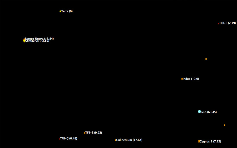
This is a section of space that is, on the X&Y plane, near Earth. See it up there, listed as "Terra (0)"? The (0), of course, represents its Z-coordinate.
Now, everything here looks pretty close to Earth (in interstellar terms, that is, this is the nearby neighborhood.) But there's one bit that's pretty deceptive. "Eeio" looks, at a glance, to be just almost as close to Earth as Indus or Cygnus 1. But it's not, of course, as it's 63.45 light years away on the Z-plane. It's pretty far away... but in our 2-D representation, it's right there.
So I'm still working on figuring out a good way to show that visually, besides the Z-coordinate marker. We'll see what I work out.
No comments:
Post a Comment